Green for All
Funder
Nature in Towns and Cities Programme, a collaboration between the National Lottery Heritage Fund, National Trust and Natural England.

Project Team
Liz Trenchard, Katharina Dehnen-Schmutz, Jana Fried
Collaborators
Coventry City Council are the lead partner for Green for All, other project partners are:
The National Trust,
John Muir Trust,
Historic Coventry Trust,
Warwickshire Wildlife Trust,
Grapevine Coventry and Warwickshire,
The University of Warwick,
Garden Organic,
Coventry University.
Value of Project
Nearly £1 million to Coventry City Council and its partners across Coventry.
Value to Coventry University
£98,749 and £31,373
Duration
Dec 2025 - July 2028
Project overview
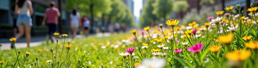
Green for All’s vision is to eradicate green deprivation in Coventry. Coventry is one of the most greenspace and nature deprived cities in England. Green for All’s ambition is to transform greenspaces across the city and work towards 30% of the city’s area supporting nature conservation by 2030. To do this the project will bring together a diverse range of experts and communities to build skills, capacity and networks through training and empowering positive action for nature. By taking a place-based approach the Green for All project will put residents and nature at the heart of local placemaking, finding bold new ways to transform how our green spaces are valued, managed, funded and used.
The Green for All project consists of three working groups:
- Mapping Green for All;
- Training and Skills; and
- Community Engagement. Researchers from the Centre for Agroecology, Water and Resilience are involved in two of these working groups.
The legacy will be a co-designed equitable place-based green and blue improvement plan for the city, supported by a sustainable funding model, a skilled workforce and volunteers, and new systems to create better connected greenspaces for local people and nature.
Dr Liz Trenchard and Dr Katharina Dehnen-Schmutz are part of the Mapping Green for All Working Group, this is a collaboration between Coventry University, University of Warwick and Coventry City Council. Their project ‘Mapping green and blue spaces in Coventry to inform strategies for improving urban green spaces for nature and communities’ aims to better understand the extent and condition of all green and blue assets across the city.
Project objectives
- Identify, map and evaluate green-blue spaces in Coventry
- Develop a methodology to assess the value of green-blue spaces for nature and for people
- Contribute to the development of information for citizens to enable them to utilise their green-blue spaces, including an interactive, freely online accessible map
- Contribute to the development of the city’s green-blue Infrastructure Plan.
The first step in the transformation planned for Green for All is to better understand the extent and condition of all green and blue assets across the city. Using GIS and community mapping Coventry University will take the lead in developing the green-blue map by collating and evaluating existing spatial data, identifying gaps and developing the methodology for assessing the value of the city’s green-blue spaces. Alongside this, the University of Warwick will use participatory mapping methods to understand the value of green-blue spaces for our communities. These data will be used to identify, evaluate and map areas of different value for nature and communities; as well as to develop a strategy for improved connectivity of habitats; and identify opportunities to create new habitats. Citizen science data will be used to identify ‘hot’ and ‘cold’ spots of citizen science activities across the city. How we evaluate and assess the value for Nature in Towns and Cities (NiTC) is a key focus of this project – resulting in a Coventry Green-Blue Score. The outputs will contribute to a user-friendly, interactive digital map hosted on the Council’s website.
Project Outputs: PhD thesis, evaluation of value of Coventry’s green-blue spaces, journal article, publicly available online map of green-blue spaces in Coventry.
Dr Jana Fried is part of the Community Growing Working Group, her project ‘Growing Primary Schools - A Learning Network for School Allotments’ aims to improve access for the city’s children to growing and green spaces.
Project Objectives:
- To expand a pilot programme connecting schools to their local allotment spaces, targeting green deprived schools and areas of Coventry
- To establish a Coventry School Allotment Network that supports co-learning among primary schools in Coventry to create school allotments actively used by pupils, families and for community events.
- To support engagement and nature connectedness in our next generation and for families who might not have this opportunity otherwise.
Many primary schools in Coventry have only limited access to green spaces for regular outdoor learning that is hands-on, immersed and build into the curriculum. They often do not have much green space on site, and easiness of accessing parks does vary and does not afford many opportunities for hands-on learning activities. However, most primary schools are near one of Coventry’s 45 existing allotments sites. Here, the establishment of “school allotments”, i.e., the allocation of a local allotment space to a primary school, can be a direct pathway to enable school children’s regular access to green spaces for hands-on, meaningful and enjoyable outdoor activities, for experiential science learning incorporated into existing school curricula, for growing healthy and sustainable fruit and vegetables that can be an inspiring way to supplement school meals. School allotments also offer a pathway to introduce families to the concepts and ‘inner workings’ of allotments, to help overcome cultural and knowledge barriers and to therefore possibly increase access for diverse communities to allotments in neighbourhoods deprived of public green spaces.
Project Outcomes: Mapping of Coventry’s schools’ access and ultisation to green/growing spaces; Establishment of an active Coventry School Allotment Network for knowledge exchange; Creation of three pilot school allotments; Creation of ‘how to ? videos; Co-creation of a city wide strategy.
Green for all – Coventry City Council
Impact statement
The impact of this Green for All project will be to improve the city’s green-blue spaces for nature and for people. Coventry is one of the most green deprived cities in England, and the city wards with the lowest green space are also our most socioeconomically disadvantaged neighbourhoods which additionally face the greatest health inequalities. The project will work to increase inclusion, access and participation through: Involving a more diverse range of people; Finding and removing barriers to access and participation; Supporting all communities to explore and share their experiences; and Creating accessible digital resources. CAWR researchers will contribute to the impact of the Green for All project by: a) providing the green-blue map which will help concentrate engagement activities in areas of green deprivation and with people who typically do not already engage with green-blue spaces, the map will inform the city’s green blue infrastructure strategy; and b) supporting primary schools in green-deprived areas of the city, and supporting nature connectedness in our next generation who might not have this opportunity at home.
By listening and learning from our residents experiences we will ensure that green equity is meaningfully incorporated into the policy, operations and programmes, reflecting the needs of our city.


